We would like to give a big Thank You for all of the feedback we have received from the early adopters so far. This is extremely helpful for the evolution of Hortis and motivating for the team. Keep them coming 🙂
In April’s “What’s New In Hortis”, our headlining feature highlight is the arrival of mapping capabilities. Also featured is the new Settings page to manage your site’s locations, as well as the ability to enter custom accession numbers. Read more about our top picks below.
Our monthly highlights for April
Mapping plant material locations
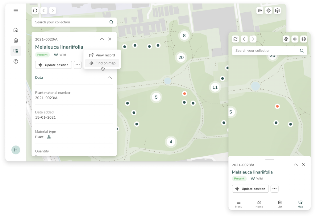
You can now view your garden map and edit the position of already-mapped plant material. Pan and zoom to explore your entire collection from the map, search for individual materials based on scientific name or accession number, and delve into records by selecting individual map markers.
If the original plant material has geolocation data, you can also go straight to the material’s position in your garden by tapping the location pin.
Our map search bar comprises the same functionality as it does in the list view of your records, meaning our flexible search algorithm will help you with streamlined queries directly from the map.
Find yourself lost or need to re-orientate yourself? We have added a couple of options to return to the centre of your garden’s map, or to return to your current location (based on your device).
We currently offer OpenStreetMap as a map base layer in Hortis; this map comprises packets of geographic data known as vector tiles, which offer much smoother zooming and panning in comparison to raster maps. This means you can expect a smooth experience even when using Hortis in the field on your mobile device. The base map in the example above is overlaid with a more detailed vector map.
We will soon offer additional base map options, such as satellite imagery, to help you view and specify the location of your material with greater flexibility.
Managing your Site’s locations
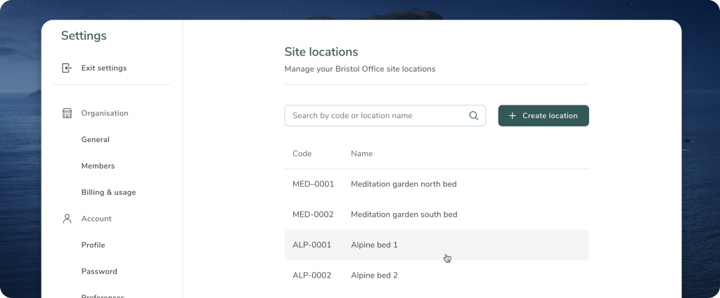
The entire list of your site’s locations can now be managed via the Settings. Here, we have added the ability to add, search, and edit locations within your garden.
Simply use the edit symbol to modify the code and name of your locations, and any changes will be automatically reflected in the location list when adding plant materials. Note that you can also add new site locations whilst recording plant material data.
Custom accession number
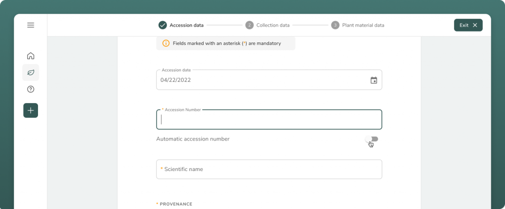
Following some feedback, we have added the ability to enter a custom accession number when creating a new accession.
When the “Automatic accession number” switch is off, you can enter a custom number. This is often the case with legacy or historic accessions, that may be retrospectively added. Switching this switch on, accession numbers will follow the automatic format of your garden (for example YYYY-####).
What’s coming next?
Our next priority for May is to roll out more mapping features, as well as to introduce image-capturing capabilities.